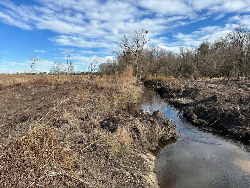
A tributary of Horse Branch flowing through cleared former cropland at the Sand Hill site in winter, before planting

Projects

Mitigation Projects

Every credit we sell traces back to one of these places: farmed land along streams that we permitted, planted and protect in perpetuity.

North Carolina · HUC 03020201

Neuse River Watershed

Nitrogen and Neuse riparian buffer credits from three approved sites in Wayne County, serving development in Raleigh, Johnston and Wayne counties within HUC 03020201.

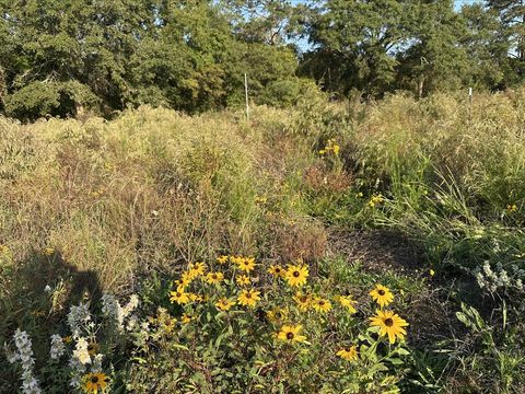
Black-eyed Susans and native grasses filling a restored field at Brooks Swamp, with mature hardwoods behind

Neuse River · Wayne County, NC · 11 acres

Brooks Swamp Mitigation Site

11 acres of former cropland along two Brooks Swamp tributaries, planted with native hardwoods in 2024. Nitrogen and Neuse buffer credits available now.

Nitrogen availableRiparian buffer available
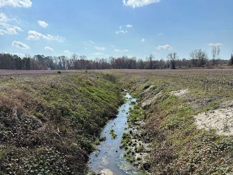
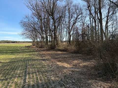
An agricultural drainage ditch running between cropland fields at the Green Heron site before restoration, with purple henbit blooming

Neuse River · Wayne County, NC · 35 acres

Green Heron Mitigation Site

35 acres on Edwards Branch and four tributary streams near Goldsboro. Existing wooded buffers preserved, cropland planted in native hardwoods. Nitrogen and buffer credits available.

Nitrogen availableRiparian buffer available
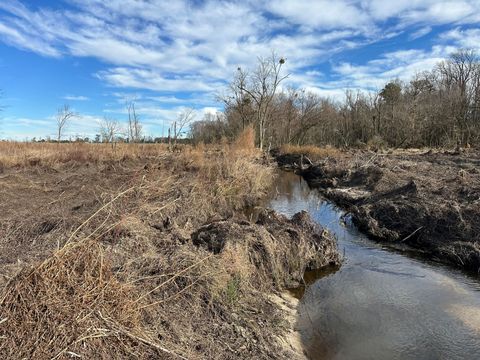
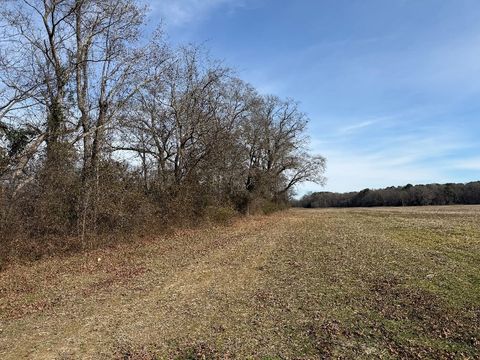
A tributary of Horse Branch flowing through cleared former cropland at the Sand Hill site in winter, before planting

Neuse River · Wayne County, NC · 33 acres

Sand Hill Mitigation Site

33 acres on Horse Branch and a tributary near Grantham. Hardwood swamp preserved, cropland planted with native hardwoods. Nitrogen and Neuse buffer credits available.

Nitrogen availableRiparian buffer available
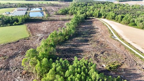
Aerial view of the Edwards Branch site showing a recently cut timber tract, a forested stream corridor, and surrounding farmland near Grantham, NC

Neuse River · Wayne County, NC · 35.4 acres

Edwards Branch Mitigation Site

35.4-acre full-delivery project for the NC Division of Mitigation Services on Edwards Branch near Grantham. About 15,000 native hardwoods to be planted in the 2026–27 dormant season.

DMS full-delivery project · planting 2026–27
Harvested crop field beside a narrow strip of bare winter hardwoods along the river at the Jacks Bluff site near Goldsboro, NC

Neuse River · Wayne County, NC · 14.3 acres

Jacks Bluff Mitigation Site

14.3-acre full-delivery project for the NC Division of Mitigation Services on the Neuse River near Goldsboro. About 11.5 acres of cropland to be planted in native hardwoods in winter 2027–28.

DMS full-delivery project · planting 2027–28
Winter farm field meeting a strip of bare hardwoods along a stream at the Heritage site in Wayne County, NC

Neuse River · Wayne County, NC · 26.9 acres

Heritage Buffer Mitigation Site

26.9-acre full-delivery project for the NC Division of Mitigation Services southwest of Goldsboro. About 15.4 acres of farmland to be planted in native hardwoods in winter 2027–28.

DMS full-delivery project · planting 2027–28

North Carolina · HUC 03030002

Jordan Lake Watershed

Nitrogen, phosphorus and riparian buffer credits for the Upper New Hope sub-watershed (Chapel Hill, Carrboro, southwest Durham), with a Haw River dam-removal bank in development.

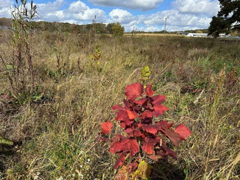
A young planted oak seedling with red autumn leaves growing in a restored meadow at Bandit Farms, with the winery buildings in the distance

Jordan Lake · Orange County, NC · 17 acres

Bandit Farms Mitigation Site

17+ acres of former cropland at a winery in the Morgan Creek headwaters, planted with native hardwoods. Buffer, nitrogen and phosphorus credits for the Upper New Hope arm of Jordan Lake.

Riparian buffer availableNitrogen availablePhosphorus available
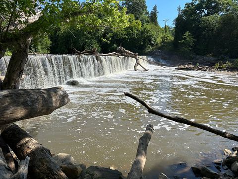
The Ossipee Mill Dam spanning Reedy Fork near Burlington, NC, with water flowing over the full width of the dam

Jordan Lake · Alamance County, NC · 13,800 linear ft

Ossipee Mill Dam Removal

Removal of a late-1800s mill dam on Reedy Fork near Burlington, restoring free flow to 13,800 linear feet of river. RestorEcology serves as mitigation bank consultant.

Stream ask us

Tennessee · HUC 06020002

Porterhouse Valley Mitigation Bank

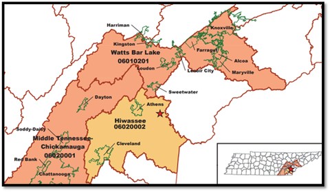
2,873 approved SQT stream credits from 6,790 feet of restored stream. Primary service area Hiwassee (06020002); secondary Watts Bar Lake and Middle Tennessee–Chickamauga.

Map of the Porterhouse Valley Mitigation Bank service areas in eastern Tennessee - Hiwassee (HUC 06020002), Watts Bar Lake (06010201) and Middle Tennessee–Chickamauga (06020001)

Tennessee · HUC 06020002

Tennessee (Porterhouse Valley)

2,873 approved SQT stream credits from 6,790 feet of restored stream. Primary service area Hiwassee (06020002); secondary Watts Bar Lake and Middle Tennessee–Chickamauga.

Stream mitigation

Need credits from one of these sites?

Send us your project location and quantity and we'll quote from the right site for your service area.